Introducing a new, occasional feature – brief overviews of some of our most popular trails, including length, difficulty, and a description of what hikers will experience.
First up: Liar’s Ridge Trail at Baker Preserve. Although much of this 2.3-mile loop trail is easy, there are obstacles and stream crossings that will be difficult for some visitors, so we rate this trail as hard.
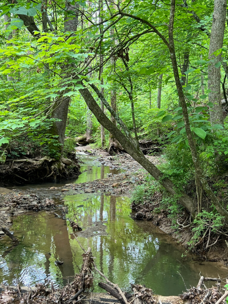
The trail includes two bridgeless crossings of Canaanville Run, so waterproof footwear is recommended. Although the stream is frequently no more than ankle-deep, it is subject to flash floods, so we don’t recommend hiking this trail during or soon after a heavy rainstorm. If in doubt, it is best to walk the trail clockwise, so that the first steam crossing is only 500 feet from the parking lot. You don’t want to walk 2.3 miles and then discover you can’t reach your car!
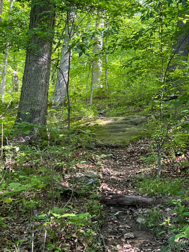
Walking clockwise, the trail entrance is right next to the kiosk. After a short walk through young woods where the trail is sometimes muddy, cross the stream, and continue on a service road. In about 300 feet, turn left onto a narrow footpath to stay on Liar’s Ridge Trail. The trail climbs steadily, including one steep spot, 0.35 mile to the top of Liar’s Ridge, intersecting Sheltered Valley Trail on the way up and again at the top.
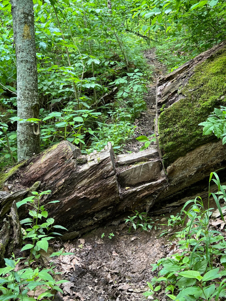
Turn right at the top to stay on Liar’s Ridge Trail, which remains on the ridge for 0.9 mile, crossing a gas line clearing and intersecting John Knouse Trail on the way. Just before the trail begins a steep descent, Picnic Rocks on the left offers a nice rest stop with flat rocks ideal for sitting. On the way down to the second crossing of Canaanville Run, you will have to climb over fallen tree trunks that were too large to remove, using steps that were cut into them. There has been a series of treefalls in this area, and fresh blockages may be encountered. This stretch of trail may be difficult for some hikers.
After passing a junction with Canaanville Run Trail, you will reach Canaanville Run. After you descend to the stream bed on a short, steep set of rock steps (which may be challenging for some hikers) and cross the stream, the continuation of the trail is about 30 feet downstream on the left. Shortly after crossing Canaanville Run, the trail ascends steeply with a small spring-fed pool on your right, followed by a scramble over the base of a large fallen tree (possibly difficult for some hikers). This forest in this area was devastated by powerful winds on May 26, 2019, but the damage was localized.
After passing a junction with Mythical Tree Trail, there are some striking rock formations on the left. After crossing the gas line clearing again, turn right at the second junction with Mythical Tree Trail to descend to a service road (which is often muddy). Turn left there and walk about 500 feet to reach the parking lot.
For more about Baker Preserve and directions, go here