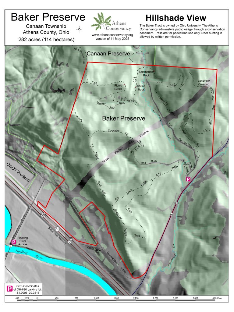
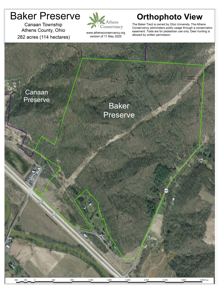
The 282-acre Baker Preserve, previously owned by the family of Dr. John Calhoun Baker, former president of Ohio University, was donated to the university in 2023. It is managed as a nature preserve under a conservation easement held by Athens Conservancy. The preserve is located near the intersection of US-50 and OH-690 and includes frontage on the Hocking River. The Hocking River Commission has a river recreational access point on the property along County Road 24A (South Canaan Road), under an agreement with the Conservancy.
Bow hunting of deer is allowed on the preserve with written permission, to reduce browsing pressure on the vegetation. Hikers should wear bright orange during deer-hunting season.
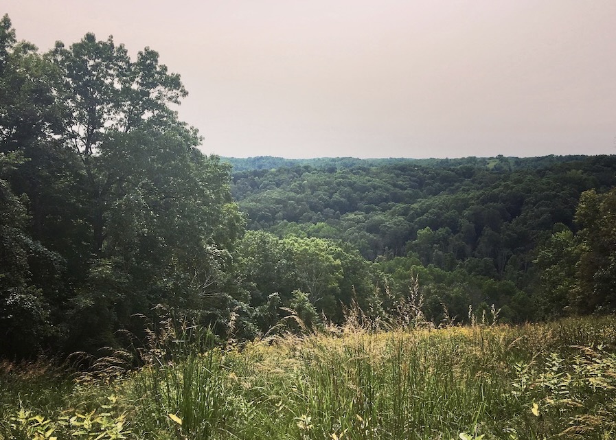
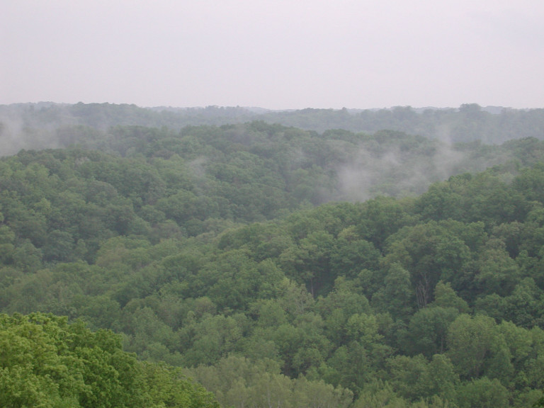
The preserve is mostly forested except for a brushy old field south of US-50, which transitions into young riparian woods near the river. Much of the forest is around 100 years old, but there are also younger woods and brushy habitat, especially along Canaanville Run, a small stream that runs through the middle of the preserve. A major gas pipeline clearing crosses the property, and there are also small gas wells that predate the conservation easement. While the resulting fragmentation of the forest is unfortunate, the pipeline clearing provides some spectacular views where trails cross it.
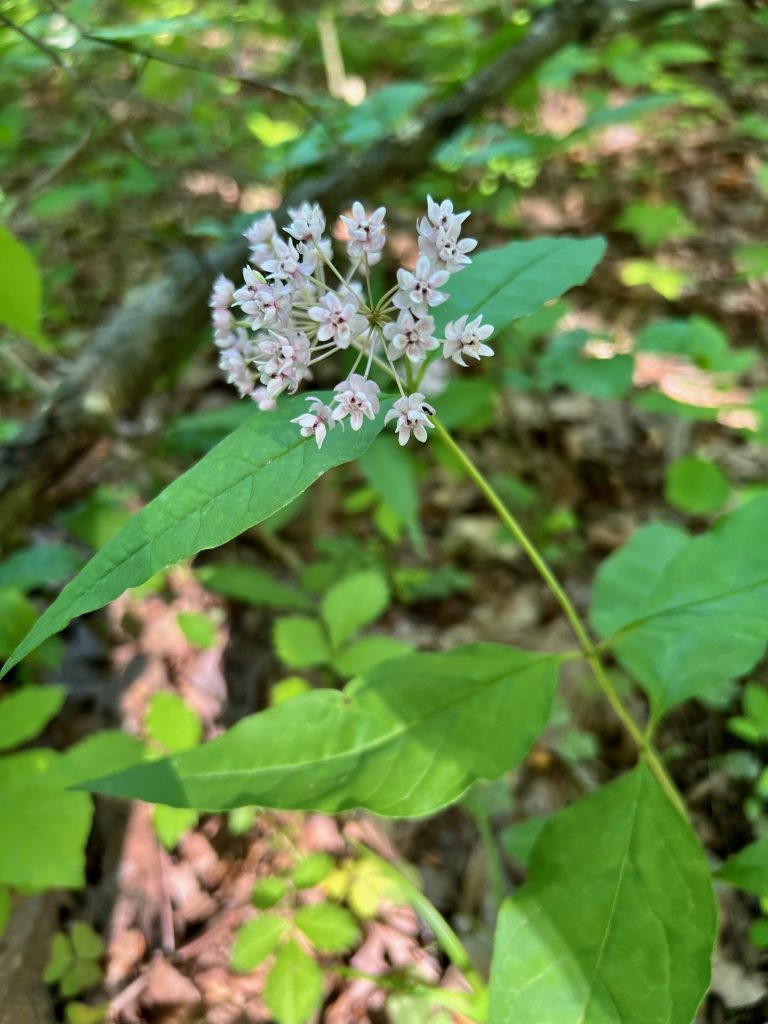
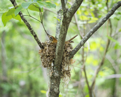
Baker Preserve is an excellent birding area from April through October. Treefall gaps in the northeastern corner of the preserve along Mythical Tree Trail and Liar’s Ridge Trail, which resulted from a 2019 windstorm, have filled in with dense shrubs and saplings, providing good nesting habitat for birds. Common breeding species in the preserve include Red-eyed Vireo, Wood Thrush, Hooded Warbler, Kentucky Warbler, Ovenbird, Louisiana Waterthrush, Acadian Flycatcher, Eastern Wood Pewee, Scarlet Tanager, and Eastern Towhee.
Trails
The Conservancy maintains a 4.8-mile trail system (see map below). The trails are for pedestrian use only. Bicycles, horses, and recreational motor vehicles are prohibited. Off-trail walking is permitted, but please be respectful of the many species of plants and small animals that live here.
Some of the trail names may arouse curiosity. Liar’s Ridge Trail refers to the tall tales told by some members of the trail crew while building it. The Mythical Tree Trail refers to a large fallen trunk that was blocking that trail when its route was initially planned, the size of which grew to mythical proportions in the minds of those who were going to have to cut it eventually. When finally cut, it turned out to be less impressive than imagined during the months of procrastination. Four pieces cut from the trunk remain along the trail as seats for hikers (though they have become too decayed since then to be very inviting). Cockatiel Ridge refers to an incident in 2008 when an Ohio University student doing a project for a botany course saw a Cockatiel in the trees, lured it down, and caught it. Not wanting to keep it herself, she took it to a pet shop a few miles away, which it turned out was the place the bird had escaped from days earlier. The famished Australian bird, unable to feed itself in the wilds of Ohio, eagerly returned to its cage and gorged itself.
Trail Descriptions:
Liar’s Ridge Trail
(2.3-mile loop; difficulty – hard)
Although much of the trail is easy, there are obstacles and stream crossings that will be difficult for some visitors, so we rate this trail as hard. A detailed description can be found here.
Mythical Tree Trail
(difficulty – moderate)
This 0.95-mile trail begins and ends on Liar’s Ridge Trail. It includes some steep slopes, but there are also long level stretches. It passes through relatively old forest the whole way, except when crossing the gas line clearing, which offers splendid views of the surrounding hills. The northern half of the trail suffered damage in the May 26, 2019 windstorm but the forest is still attractive. We particularly recommend a 1.7-mile loop that combines the Mythical Tree and the contiguous part of the Liar’s Ridge Trail.
Cockatiel Ridge Trail
(difficulty – moderate)
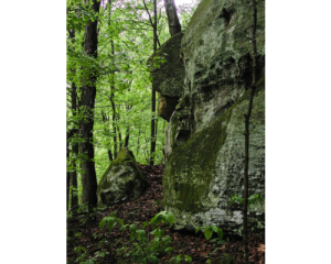
This 0.5-mile trail begins and ends on Liar’s Ridge Trail. It climbs steadily from east to west. The eastern 0.3 mile follows a service road, which is steep in places and often muddy. This section offers attractive views of a wooded valley to the south before turning abruptly right (north) and climbing sharply to cross the gas line clearing. The western 0.2 mile offers an easy, gradual climb through mature oak-hickory forest with very little understory. At the upper end of the trail, where it meets Liar’s Ridge Trail, there is an adjacent hilltop with limestone bedrock and a Shumard oak, a species that is rare in southeastern Ohio.
Sheltered Valley Trail
(difficulty – easy)
This 0.65-mile trail begins and ends on Liar’s Ridge Trail. Most of it passes through relatively young forest with a dense, shrubby understory. It provides good bird habitat, and the abundance of fruiting spicebush in the fall attracts migrating thrushes. The limestone bedrock underlying the portion of the trail that runs on the ridge top supports a population of blue ash, which is uncommon in southeastern Ohio. This species is less susceptible to the emerald ash borer than our other ashes, but many of the blue ash trees on this ridge eventually succumbed to this non-native beetle. Nevertheless, some young blue ashes persist (as of 2022). Blue ash is easily recognized by its four-angled twigs (square in cross section).
Broken Jug Trail
(difficulty – easy)
This 0.35-mile trail begins and ends on Liar’s Ridge Trail. It offers a way to circumvent one of the steepest parts of the Liar’s Ridge Trail and avoid climbing over fallen trees. The eastern end of it, where it crosses a tiny stream, is often muddy, but the trail is otherwise easy to walk.
Access to this property is primarily via a trailhead off Ohio State Route 690. To reach this trailhead from Athens, take US-50 east from US-33 5.1 miles to OH-690. Turn left on OH-690 and go 0.5 mile to the gravel parking area on the left. Carsonite signs and paint blazes guide visitors on the trails.
Use iNaturalist to help document plants, mushrooms, insects, birds, mammals, and more in the Baker Preserve!
Volunteer Preserve Steward: Aimee Delach
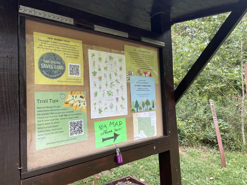
Maps
(click to enlarge)

Liar’s Ridge Trail Details
(2.3-mile loop; difficulty – hard)

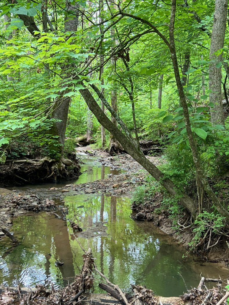
Includes two bridgeless crossings of Canaanville Run, so waterproof footwear is recommended. Although the stream is frequently no more than ankle-deep, it is subject to flash floods, so we don’t recommend hiking this trail during or soon after a heavy rainstorm. If in doubt, it is best to walk the trail clockwise, so that the first steam crossing is only 500 feet from the parking lot. You don’t want to walk 2.3 miles and then discover you can’t reach your car! Although much of the trail is easy, there are some obstacles and stream crossings that will be difficult for some visitors, so we rate this trail as hard.
Walking clockwise, the trail entrance is right next to the kiosk. After a short walk through young woods where the trail is sometimes muddy, cross the stream, and continue on a service road. In about 300 feet, turn left onto a narrow footpath to stay on Liar’s Ridge Trail. The trail climbs steadily, including one steep spot, 0.35 mile to the top of Liar’s Ridge, intersecting Sheltered Valley Trail on the way up and again at the top.
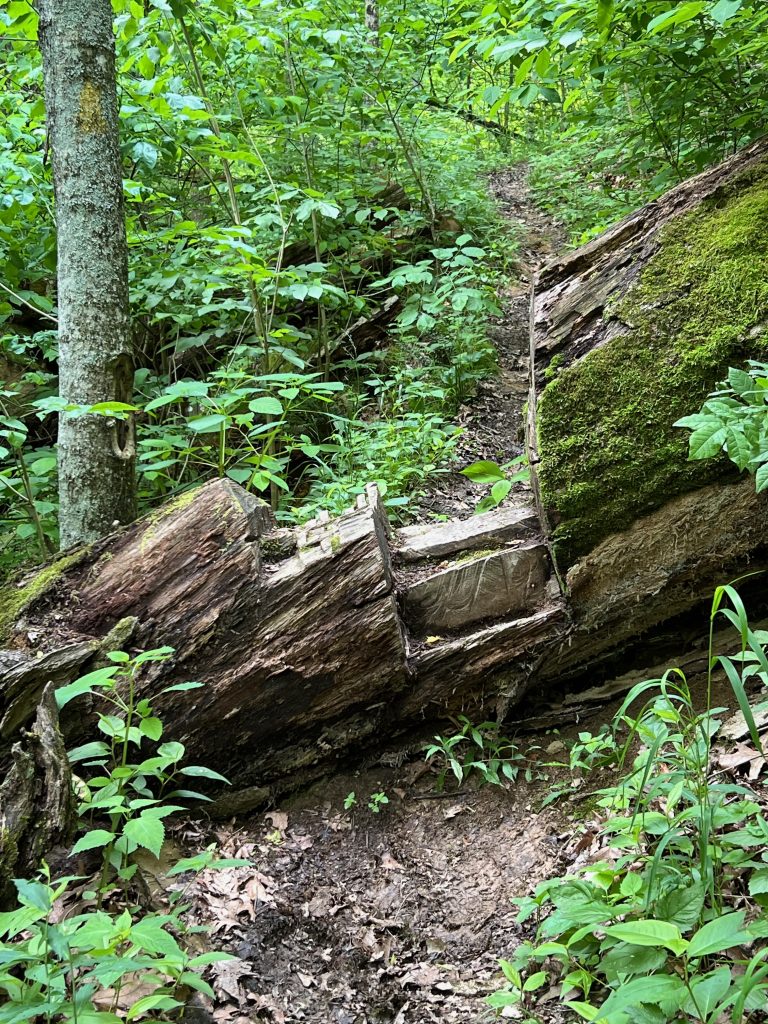
Turn right at the top to stay on Liar’s Ridge Trail, which remains on the ridge for 0.9 mile, crossing a gas line clearing and intersecting John Knouse Trail on the way. Just before the trail begins a steep descent, Picnic Rocks on the left offers a nice rest stop with flat rocks ideal for sitting. On the way down to the second crossing of Canaanville Run, you will have to climb over fallen tree trunks that were too large to remove, using steps that were cut into them. There has been a series of treefalls in this area, and fresh blockages may be encountered. This stretch of trail may be difficult for some hikers.
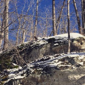
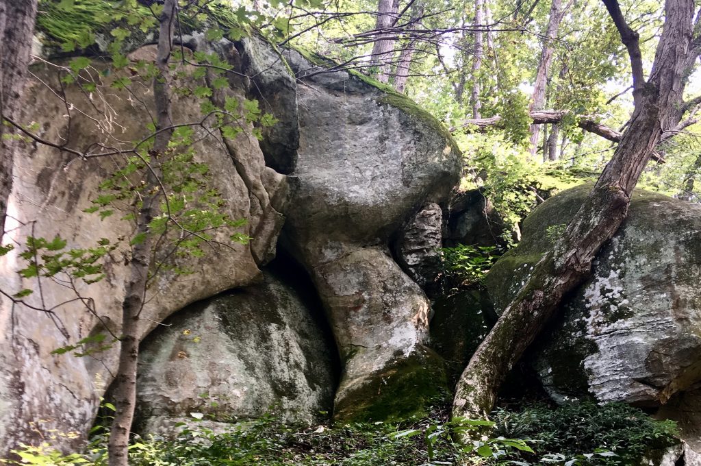
After passing a junction with Canaanville Run Trail, you will reach Canaanville Run. After you descend to the stream bed on a short, steep set of rock steps (which may be challenging for some hikers) and cross the stream, the continuation of the trail is about 30 feet downstream on the left. Shortly after crossing Canaanville Run, the trail ascends steeply with a small spring-fed pool on your right, followed by a scramble over the base of a large fallen tree (possibly difficult for some hikers). This forest in this area was devastated by powerful winds on May 26, 2019, but the damage was localized. After passing a junction with Mythical Tree Trail, there are some striking rock formations on the left. After crossing the gas line clearing again, turn right at the second junction with Mythical Tree Trail to descend to a service road (which is often muddy). Turn left there and walk about 500 feet to reach the parking lot.