

Shawnee
State Park

| Shawnee State Park at a Glance | |
| Date established: | 1922 as Theodore Roosevelt State Game Preserve, 1949 split into Shawnee State Park and State Forest |
| Acreage (total): | 1,095 acres (443 hectares) the above figure is stated on the park website, but the forest brochure states that the park is 1,165 acres embedded in the 63,000-acre Shawnee State Forest |
| Water acreage: | 70 acres (28 hectares)in 3 lakes: Bearl, Roosevelt, Turkey Creek |
| Boat ramps: | Two (one each in Turkey Creek and Roosevelt Lakes) |
| Miles of trails: | about 15 miles total within the park (24 kilometers) miles total in the state park and state forest ( kilometers) |
| Trail miles open to horses: | about 75 miles in the state forest (120 kilometers) |
| RV-friendly campsites: | 107 electric (includes two camper cabins) |
| Horse camp: | 57 sites |
| Group camp: | Accommodates up to 45 people |
| Cottages: | 25 2-bedroom cottages |
| Lodge: | 50 rooms |
| Hunting: | No hunting, but allowed in the adjacent state forest |
| Official park website: | http://parks.ohiodnr.gov/shawnee |
The park was, for a short time, renamed Portsmouth State Park in the early 1970s, but the name was shortly reverted to Shawnee.
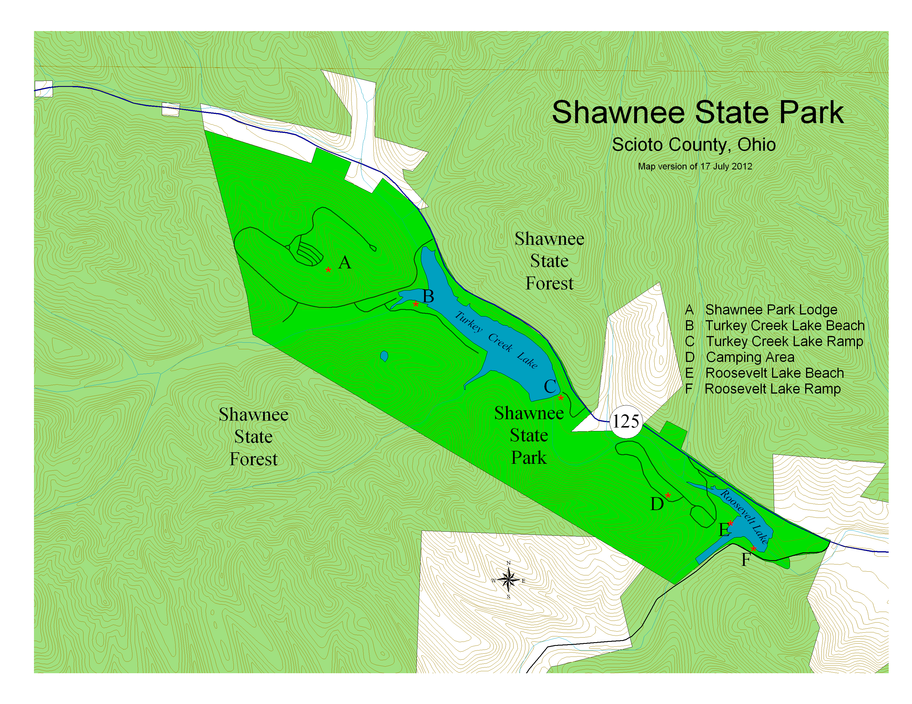
There are three lakes at Shawnee State Park, but one, Bear Lake, is really just a pond. Each of the other two, Turkey Creek (the largest) and Roosevelt, has a boat ramp and a swimming beach. Only electric motors are allowed on the lakes. The boat ramp at Roosevelt Lake has a significant dropoff at water's edge, so don't try backing a vehicle all the way into the water.
There are also a basketball court, a tennis court, a volleyball court, a miniature golf course, a shuffleboard court, two picnic shelters, a nature center, a playground and an amphitheater.
Directly bordering the state park on the map, but several miles away by road is the 69-acre Boy Scout Camp Oyo. Some distance to the west, there is an 8000-acre wilderness area that is part of the Shawnee State Forest, the only designated wilderness area in Ohio.

Shawnee Hiking Trails
|
Shawnee Horse Trails
|

