


|
|
| |
Moonville Rail-Trail | ||
| Moonville Rail-Trail Website | ||
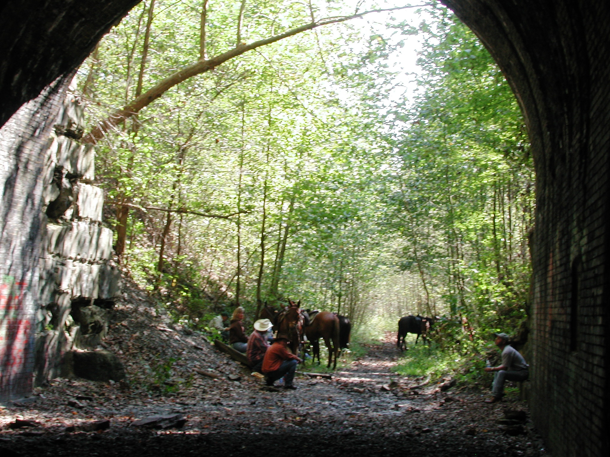 |
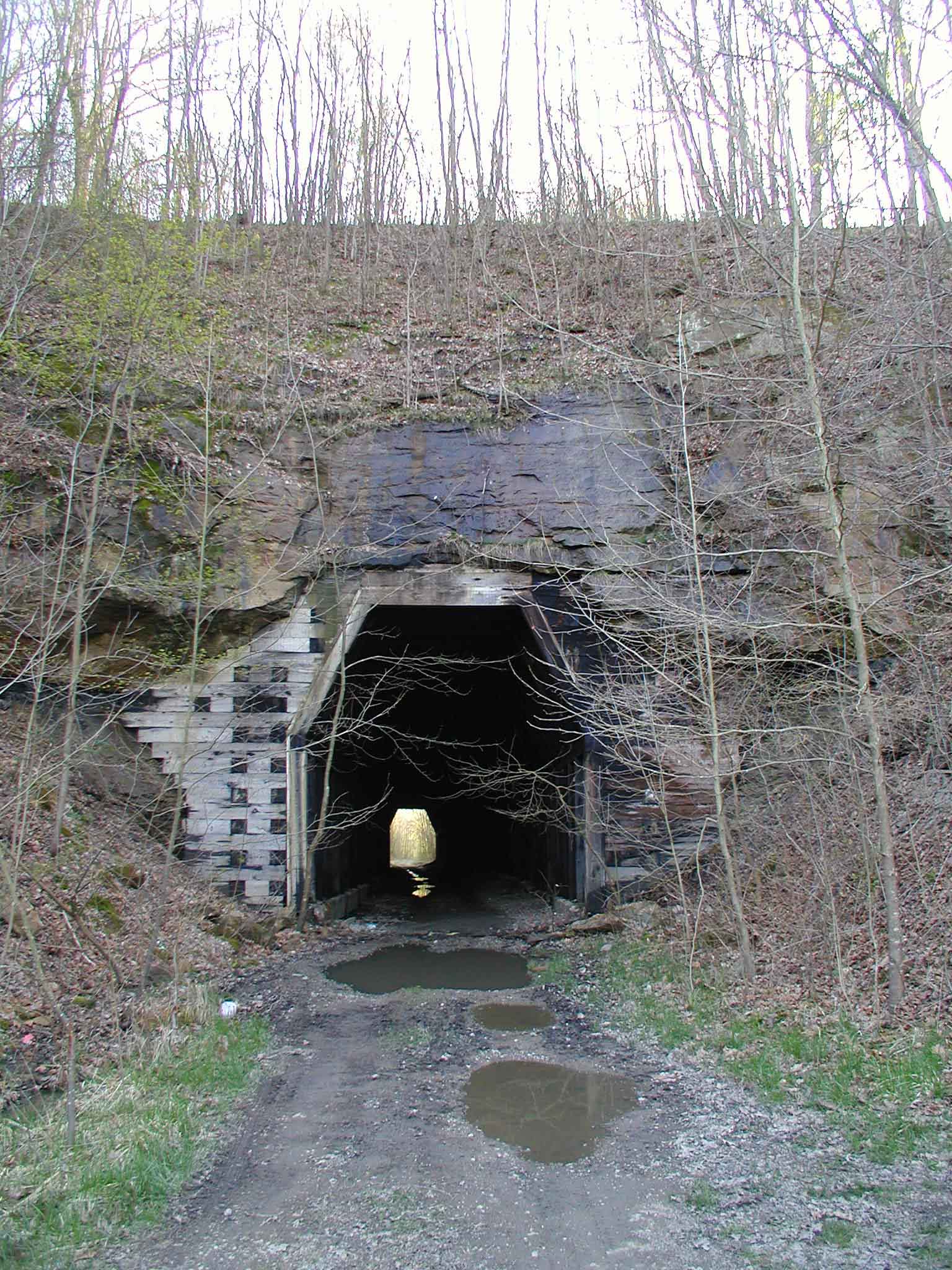
Moonville Rail-Trail is known to be the former railroad right-of-way of the B&O (Baltimore & Ohio) Railroad, but it is actually the railroad grade of the oldest railway in our area, the Marietta-Cincinnati Railroad, established in 1853. This was long known as the most desolate, wildest stretch on the entire B&O line, and is still, today, known for its beauty. Even more, it is well-known for the masonry Moonville Tunnel (shown in the photo to the left), which is reputed to be haunted. There is a second tunnel (shown in the photo to the right), the King Switch Tunnel, which is a timber tunnel near Mineral.
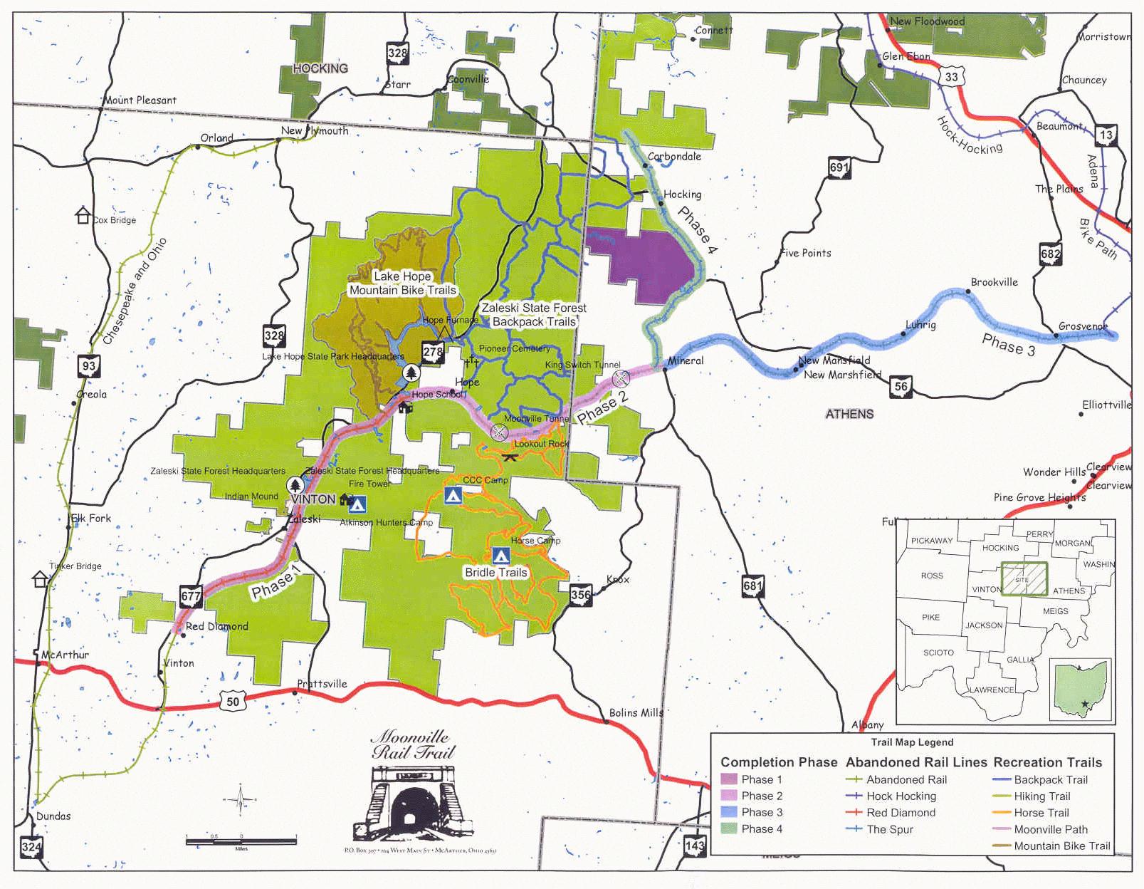
The current rail-trail is 16 miles long, extending from the Diamond Powder Plant south of Zaleski in Vinton County to the community of Mineral in Athens County. The Vinton County portion is owned by Vinton County, while the Athens County portion is owned by Athens County. Much of the rail-trail is embedded within the Zaleski State Forest. As yet, only two of the many missing bridges have been replaced, providing a continuous 6.1 miles of accessible trailway. Another bridge at Moonville Tunnel is underway, but construction has been stalled by a freeze in state funding under the current governor. Moonville Rail-Trail, Inc., and the Athens Conservancy are working to try to connect the Moonville Rail-Trail with the Hockhocking Adena Bikeway. So far, about three additional miles of right-of-way have been secured. |
 |
The Moonville Rail-Trail is open for 1.4 miles continuous from OH-278 southwest, but there is no access to the far end of this stretch. There is access at 1.0 mile from Township Road F3. Then, from OH-278 northeast, the trail is open for 4.7 miles to the next missing bridge, over Racccoon Creek. In this stretch, two bridges have been replaced by using railroad flat cars. To see one, park at the parking pulloff on for the Little Sandy Trail along OH-278 a little bit south of Lake Hope dam. Walk south about a tenth of a mile and there will be a small trail on the east side of the road that gains access to the trail. Turn right and walk half a mile. The far end of the open stretch can be reached by turning onto Wheelabout Road from OH-278, right across from the Lake Hope dam. Go straight and it becomes Shea Road (you have to turn almost immediately to stay on Wheelabout). Keep going straight on Shea, and it becomes Hope-Moonville Road. Continue on this until it crosses the railroad grade, then immediately loops back in a tight loop to cross it again. Park here (at 1.6 miles from OH-278), and if you walk a short distance east, you’ll see the missing Raccoon Creek bridge. But you can walk to the west for 6.1 miles. If you continue on the Hope-Moonville Road another 1.0 mile, you’ll come to the grade crossing adjacent to the construction site for the Moonville bridge. You can see it from the road, just to the east. This construction was well underway when it was stalled by suspension of state funding.
Access points for the Moonville Trail:
Unfortunately, the Vinton County Commissioners have placed barriers across the road that largely disregard its use as a trail, and there’s just barely enough room to squeeze around the ends of these. |
 | |
 | ||